Mangueira
Mangueira | |
|---|---|
Neighborhood | |
| Coordinates: 22°54′14″S 43°14′13″W / 22.90389°S 43.23694°W | |
| Country | |
| State | Rio de Janeiro (RJ) |
| Municipality/City | Rio de Janeiro |
| Zone | Centro |
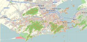
Mangueira (Mango Tree) is a shantytown neighborhood (favela) in the city of Rio de Janeiro, Brazil, centered on the Mangueira hill or morro.[1] It is most famous for its samba school[2], the Estação Primeira de Mangueira (First Mangueira [train] Station) or simply Mangueira, which is one of strongest competitors in the annual Rio Carnival samba competition.[3]
- ^ "HISTÓRIA DO MORRO – Mangueira" (in Brazilian Portuguese). Retrieved 2024-06-03.
- ^ Zeldenrust, Jan Willem (2020-01-24). "Visit a favela in Rio de Janeiro - see the other side in Mangueira". Gringo-Rio. Retrieved 2024-06-03.
- ^ "Mangueira, the samba school – Estrela da Favela". Retrieved 2024-06-03.


